Hurricane hunter planes, the intrepid aircraft that venture into the heart of raging hurricanes, play a crucial role in monitoring and forecasting these powerful storms. These specialized planes, equipped with advanced instruments and technology, gather vital data that helps meteorologists predict a hurricane’s path, intensity, and potential impact. From their humble beginnings in the 1940s, hurricane hunter planes have evolved significantly, becoming essential tools for protecting lives and property.
These daring missions, undertaken by highly skilled pilots and crew, provide invaluable insights into the complex dynamics of hurricanes. The data they collect allows for more accurate forecasts, enabling communities to prepare for the storm’s arrival and mitigate its potential devastation. The history of hurricane hunter planes is a testament to human ingenuity and dedication in the face of nature’s most powerful forces.
Instruments and Technology

Hurricane hunter planes are equipped with an array of sophisticated instruments to collect vital data about hurricanes. These instruments allow meteorologists to understand the structure, intensity, and movement of these powerful storms, ultimately contributing to improved forecasts and warnings.
Measuring Wind Speed, Air Pressure, and Temperature
The primary objective of hurricane hunter missions is to gather data on the storm’s core and surrounding environment. This data is crucial for understanding the hurricane’s strength and potential for intensification.
- Dropwindsonde: This instrument is a small, expendable package that is dropped from the aircraft. As it descends through the atmosphere, it measures wind speed and direction, temperature, humidity, and air pressure. The data is transmitted back to the aircraft in real-time.
- Airborne Doppler Radar: This radar system transmits radio waves that bounce off raindrops and other particles in the atmosphere. The Doppler effect allows the radar to determine the speed and direction of these particles, providing a detailed picture of the hurricane’s wind field.
- GPS Dropwindsonde: This advanced version of the dropwindsonde incorporates a GPS receiver to track its position and speed. This allows for more accurate wind measurements, particularly in regions with strong winds and turbulence.
Data Analysis and Transmission
The data collected by hurricane hunter instruments is transmitted back to the National Hurricane Center (NHC) in real-time via satellite or radio.
- Advanced Data Processing: The NHC uses sophisticated computer models to analyze the data and generate forecasts. These models incorporate data from multiple sources, including hurricane hunter missions, satellite imagery, and surface observations.
- Real-time Data Sharing: The data collected by hurricane hunter planes is shared with other weather agencies around the world, contributing to a global understanding of hurricane activity.
Flight Operations and Procedures

Hurricane hunter missions involve a carefully planned and executed flight path, designed to gather crucial data about the storm’s structure and intensity. The procedures followed during these missions are essential for ensuring the safety of the crew and the accuracy of the collected data.
Flight Path and Procedures
The flight path of a hurricane hunter aircraft is determined by the specific objectives of the mission and the characteristics of the storm. Typically, the aircraft will fly into the storm’s eye, making repeated passes through the eyewall, the area of most intense winds and rainfall. This allows the crew to gather data on the storm’s structure, including its size, intensity, and direction of movement.
- The aircraft typically flies at altitudes between 10,000 and 20,000 feet, depending on the storm’s intensity and the type of data being collected.
- The flight path is often divided into segments, with each segment focused on collecting specific types of data. For example, one segment might be dedicated to measuring wind speed and direction, while another segment might be used to collect data on the storm’s rainfall and cloud structure.
- The aircraft’s flight path is constantly adjusted based on the storm’s movement and the data being collected. This allows the crew to stay within the storm’s core and gather the most accurate data possible.
Navigation and Tracking, Hurricane hunter plane
Hurricane hunters use a variety of sophisticated navigation and tracking systems to navigate through the storm and track its movement. These systems include:
- Global Positioning System (GPS): GPS provides the aircraft’s precise location and altitude.
- Inertial Navigation System (INS): INS provides the aircraft’s position, velocity, and heading, even when GPS signals are unavailable.
- Doppler Radar: Doppler radar allows the crew to see the storm’s structure and track its movement in real time.
- Weather Satellites: Weather satellites provide a broad view of the storm and its environment, allowing the crew to track its movement and development.
These systems work together to provide the crew with a comprehensive understanding of the storm’s characteristics and its movement.
Risks and Challenges
Hurricane hunter missions are inherently risky, and pilots and crew face a number of challenges during their flights.
- Severe Turbulence: Hurricane eyewalls are characterized by extreme turbulence, which can cause the aircraft to pitch, roll, and yaw violently. This turbulence can be dangerous for both the aircraft and the crew.
- Low Visibility: Heavy rainfall and clouds can reduce visibility significantly, making it difficult for pilots to navigate the storm and avoid obstacles.
- Lightning: Hurricanes are associated with frequent lightning strikes, which can pose a serious threat to the aircraft and its crew.
- High Winds: Hurricane winds can reach speeds of over 150 miles per hour, putting a significant strain on the aircraft and its systems.
- Sea State: If the aircraft needs to land or take off from a seaplane base, the rough seas can make it difficult and dangerous.
Despite these risks, hurricane hunters are highly trained and experienced professionals who are dedicated to providing valuable data to help protect lives and property.
Data Collection and Analysis

Hurricane hunters gather crucial data that significantly enhances the accuracy of hurricane forecasts. This information is used to improve the understanding of storm development, track movement, and predict intensity, ultimately leading to better preparedness and mitigation efforts.
The Role of the National Hurricane Center
The National Hurricane Center (NHC) plays a pivotal role in analyzing and disseminating data collected by hurricane hunters. The NHC is responsible for issuing hurricane advisories, watches, and warnings, and its forecasts are used by emergency managers, government agencies, and the public to prepare for potential impacts.
- The NHC receives data from various sources, including hurricane hunters, satellites, surface observations, and weather radar.
- This data is processed using advanced computer models and analysis techniques to generate forecasts of a hurricane’s track, intensity, and potential impacts.
- The NHC also provides guidance to local authorities on hurricane preparedness and mitigation measures.
The Impact of Hurricane Hunter Data on Preparedness and Mitigation
Data collected by hurricane hunters has significantly improved the accuracy of hurricane forecasts, leading to better preparedness and mitigation efforts.
- Accurate forecasts allow for timely evacuations, which can save lives and reduce property damage.
- Hurricane hunter data enables the development of more effective mitigation strategies, such as strengthening infrastructure and improving disaster response plans.
- The availability of real-time data allows for more precise warnings and alerts, giving people more time to prepare and take necessary precautions.
Hurricane hunters have been instrumental in improving our understanding of hurricanes and have saved countless lives by providing critical data that allows for better preparedness and mitigation efforts.
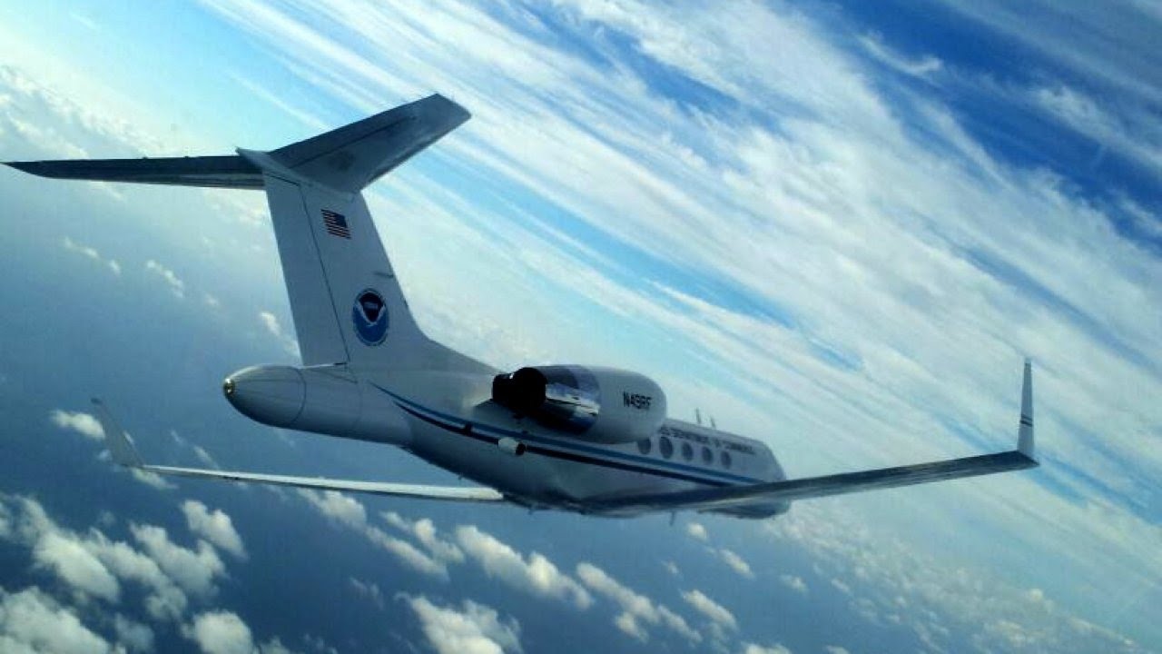
Hurricane Hunter Planes

Hurricane hunter planes are crucial for understanding and predicting hurricane behavior, playing a vital role in saving lives and protecting property. These aircraft fly directly into hurricanes, gathering vital data that helps meteorologists issue timely and accurate warnings, enabling communities to prepare and evacuate if necessary.
Hurricane Hunter Planes: A Vital Tool for Public Safety
The data collected by hurricane hunter planes is essential for public safety and disaster preparedness. Here’s how:
- Accurate Forecasts and Warnings: The data collected by hurricane hunter planes helps meteorologists to improve the accuracy of hurricane forecasts and warnings. This allows officials to issue timely and effective evacuation orders, giving people more time to prepare for the storm’s impact. For example, in 2017, Hurricane Irma’s path was predicted with remarkable accuracy thanks to data gathered by hurricane hunter planes, allowing for timely evacuations and saving countless lives.
- Understanding Hurricane Structure and Intensity: By flying through hurricanes, hurricane hunter planes gather data on the storm’s structure, intensity, and movement. This information helps meteorologists to understand how hurricanes evolve and to predict their future path. This data is crucial for making informed decisions about emergency response and resource allocation.
- Real-Time Monitoring: Hurricane hunter planes provide real-time monitoring of hurricanes, allowing meteorologists to track changes in the storm’s intensity and path. This allows for timely adjustments to evacuation orders and other emergency response measures.
Ongoing Research and Development
Ongoing research and development efforts are constantly enhancing hurricane hunter capabilities, leading to even more accurate and timely forecasts. These advancements include:
- Improved Sensors and Technology: New sensors and technology are being developed to collect even more detailed data about hurricanes, including information on the storm’s wind speed, pressure, and rainfall. This data is used to refine hurricane models and improve forecast accuracy.
- Unmanned Aerial Vehicles (UAVs): UAVs are being used to gather data from hurricanes, offering a cost-effective and flexible alternative to manned aircraft. UAVs can fly closer to the storm’s center and collect data in areas that are too dangerous for manned aircraft.
- Data Assimilation and Modeling: Researchers are working on improved data assimilation and modeling techniques to incorporate the data collected by hurricane hunter planes into hurricane models more effectively. This will lead to even more accurate and reliable forecasts.
Hurricane hunter planes, with their brave crews, face the fury of nature head-on, collecting vital data to help predict and prepare for devastating storms. This dedication to safety echoes the themes of betrayal and deceit in the classic Korean film, the housemaid movie , where a seemingly innocent domestic worker’s true intentions unravel, creating chaos within a seemingly stable household.
Both the hurricane hunters and the film’s characters navigate complex situations, showcasing the importance of understanding hidden currents and anticipating potential consequences.
Hurricane hunter planes, equipped with sophisticated instruments, brave treacherous storms to gather crucial data. While these missions are vital for forecasting and preparing for natural disasters, the technology used in these aircraft can also have applications in other areas, such as monitoring potential threats like the ongoing Israel-Iran nuclear standoff.
The data collected by hurricane hunter planes could potentially provide valuable insights into the potential consequences of a nuclear conflict, allowing for better preparedness and response strategies.
